You can sponsor this page

Dysomma longirostrum Chen & Mok, 2001

Add your observation in Fish Watcher
Native range | All suitable habitat | Point map | Year 2050
This map was computer-generated and has not yet been reviewed.
Dysomma longirostrum   AquaMaps   Data sources: GBIF OBIS
Upload your photos and videos
Pictures | Google image
Image of Dysomma longirostrum
No image available for this species;
drawing shows typical species in Synaphobranchidae.


New Caledonia country information

Common names: [No common name]
Occurrence: native
Salinity: marine
Abundance: | Ref:
Importance: | Ref:
Aquaculture: | Ref:
Regulations: | Ref:
Uses: no uses
Comments: Second record of Dysomma longirostrum taken from Norfolk Ridge, Coral Sea at 540 m (Ref. 106136).
National Checklist:
Country Information: https://www.cia.gov/library/publications/resources/the-world-factbook/geos/nc.html
National Fisheries Authority:
Occurrences: Occurrences Point map
Main Ref: Ho, H.-C., D.G. Smith and K.A. Tighe, 2015
National Database:

Common names from other countries

Classification / Names Populärnamn | synonymer | Catalog of Fishes(Släkte, Arter) | ITIS | CoL | WoRMS | Cloffa

> Anguilliformes (Eels and morays) > Synaphobranchidae (Cutthroat eels) > Ilyophinae
Etymology: Dysomma: Greek, dys, dyo = two + Greek, omma = eye;  longirostrum: Specific name refers to its long snout..

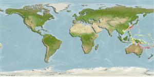
Environment: milieu / climate zone / depth range / distribution range Ekologi


Warning: mysqli::__construct(): (HY000/1040): Too many connections in /var/www/html/includes/func_getlabel.php on line 46
Can't connect to MySQL database (fbapp). Errorcode: Too many connections