You can sponsor this page

Parapercis australis Randall, 2003

Add your observation in Fish Watcher
Native range | All suitable habitat | Point map | Year 2050
This map was computer-generated and has not yet been reviewed.
Parapercis australis   AquaMaps   Data sources: GBIF OBIS
Upload your photos and videos
Pictures | Videos | Google image
Image of Parapercis australis
Parapercis australis
Picture by Randall, J.E.


Australia country information

Common names: Southern grubfish
Occurrence: native
Salinity: marine
Abundance: | Ref:
Importance: | Ref:
Aquaculture: | Ref:
Regulations: | Ref:
Uses: no uses
Comments: Type locality: Queensland, Great Barrier Reef, Capricorn Group, One Tree Island, rubble and sand bottom next to lagoon patch reef in 3 m, BPBM 14484 (holotype of Parapercis australis, 8.48 cm SL, female). Lord Howe island, QLD; Lizard island to Escape Reef, Great Barrier Reef, QLD (Ref. 75154).
National Checklist:
Country Information: https://www.cia.gov/library/publications/resources/the-world-factbook/geos/as.html
National Fisheries Authority: http://www.csiro.au/
Occurrences: Occurrences Point map
Main Ref: Randall, J.E., 2003
National Database:

Common names from other countries

Classification / Names Nombres comunes | Sinónimos | Catalog of Fishes(Género, Especie) | ITIS | CoL | WoRMS | Cloffa

> Perciformes/Uranoscopoidei (Sand dwellers) > Pinguipedidae (Sandperches)
Etymology: Parapercis: Greek, para = the side of + Greek, perke = perch (Ref. 45335);  australis: Named for its southern distribution, south of 14° south latitude..
  More on author: Randall.

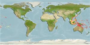
Environment: milieu / climate zone / depth range / distribution range Ecología


Warning: mysqli::__construct(): (08004/1040): Too many connections in /var/www/html/includes/func_getlabel.php on line 46
Can't connect to MySQL database (fbapp). Errorcode: Too many connections