You can sponsor this page

Atrophacanthus japonicus (Kamohara, 1941)

Добавить Ваши наблюдения в Fish Watcher
Native range | All suitable habitat | Point map | Year 2050
This map was computer-generated and has not yet been reviewed.
Atrophacanthus japonicus   AquaMaps   Data sources: GBIF OBIS
Загрузить свой Фото и Видео
Pictures | Изображение на Google
Image of Atrophacanthus japonicus
Atrophacanthus japonicus
Picture by CSIRO


Japan country information

Common names: Ukeguchikawamuki
Occurrence: native
Salinity: marine
Abundance: | Ref:
Importance: | Ref:
Aquaculture: | Ref:
Regulations: | Ref:
Uses: no uses
Comments: Occurs off the Kochi Prefecture. Also Ref. 6660.
National Checklist:
Country Information: https://www.cia.gov/library/publications/resources/the-world-factbook/geos/ja.html
National Fisheries Authority: http://www.maff.go.jp/eindex.html
Occurrences: Occurrences Point map
Main Ref: Masuda, H., K. Amaoka, C. Araga, T. Uyeno and T. Yoshino, 1984
National Database:

Common names from other countries

Классификация / Names народные названия | синонимы | Catalog of Fishes(род, виды) | ITIS | CoL | WoRMS | Cloffa

> Tetraodontiformes (Puffers and filefishes) > Triacanthodidae (Spikefishes) > Triacanthodinae
Etymology: Atrophacanthus: Greek, atrophos, -os, -os = not edible + Greek, akantha = thorn; Atrophos has also the meaning of languid, exhausted (Ref. 45335).

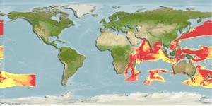
Environment: milieu / climate zone / depth range / distribution range экология


Warning: mysqli::__construct(): (08004/1040): Too many connections in /var/www/html/includes/func_getlabel.php on line 46
Can't connect to MySQL database (fbapp). Errorcode: Too many connections